Bangalore Map
Bangalore' map offers a detailed and comprehensive view of one of India's top IT hubs. Located in the southern part of Karnataka, the map gives insights into the roads, amenities, and localities. The map features a dynamic blend of all the top localities from Whitefield to Devanahalli. To locate the map on Google, viewers can check its coordinates:
- Latitude: 12.9537902
- Longitude: 77.3012781
This well-planned map gives all the details of the city's direction from one place to another. It also gives information on the nearest residential projects, commercial buildings, and many more. Whether a localite, visitor, or an investor, the city's map is an important tool. It helps in exploring and understanding the different areas and features of this large city.
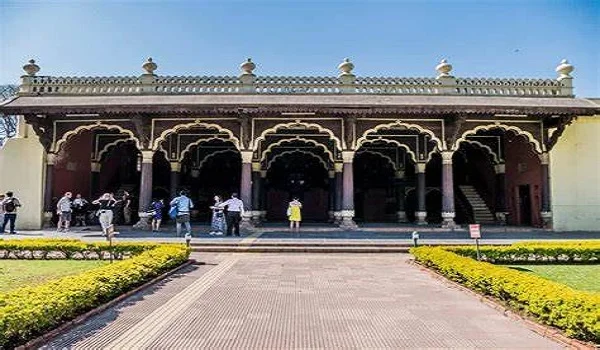
Bangalore, or Bengaluru, is a marvelous IT hub known as the Silicon Valley of India. It has a huge population of 10 million and has attracted major global companies. The city is famous for its bustling tech industry and is home to over 67 K firms. The city is spread over a vast land area of 740 sq. Km. and has a pleasant weather. These firms have given many jobs to the mass population in the city. The city also boasts many residential projects by the premium builders like Prestige Group. These builders have shaped the city's infrastructure and have upgraded the map by launching lavish projects like Prestige Raintree Park. The city also features the ISRO headquarters and has many large tech parks.
Bangalore Map Direction is in the Southern part of India, and the city has 5 towns with 4 Taluks and 5 zones. There are 9 districts in the city and mainly they are divided into Urban and Rural.
The directions of the Bangalore Rural map are in the southeastern part of Karnataka, covering 5,814 sq km. It lies between latitudes 12°15' N and 13°35' N and longitudes 77°05' E and 78° E.
Bangalore Urban Map is spread over 2196 sq. Km. of land area and features 5 Taluk.
The 5 Zones of the city are:
- East Zone - Some of the important areas of the zone are - Whitefield, Hoodi, Outer Ring Road, Mahadevapura, Bellandur, Sarjapur Road, Marathahalli, Indiranagar,
- West Zone - The posh area of this zone is Mallasandra. Subramanyapura. Kambipura.
- North Zone - Devanahalli, Yelahanka, Yeshwanthpur, etc are the prominent localities of the areas.
- South Zone - Jayanagar, JP Nagar, BTM Layout, Bannerghatta Road, Rajarajeshwari Nagara, etc, are the posh areas of the zone.
- Central Bangalore - Chickpet, Indira Nagar, Rajaji Nagar, R.T. Nagar, etc are its well-known locales.
The Bangalore map with cities comprises 17 hoblies, 872 villages, 11 rural settlements, 5 towns, a tier-three city, and a tier-one city. It is managed by 96 Village Panchayats, 97 Taluk Panchayats, 5 Town Municipal Councils, and 1 City Municipal Council.
Bangalore is a major tourist attraction as it has famous parks, historic places, and other places. The good public tranit facility of the city can travel these distances. The distance to all parts of the city can be easily traveled by the metro, BMTC buses, and other commuting facilities. The city's distance to other nearby cities is also proximate.
- Its distance is 7.5 km away from NICE Road, which was originally part of the planned 111 km NICE Expressway. This was meant to connect Bangalore and Mysore, but the project was later scrapped.
- From the Bangalore City railway station (SBC) to the airport is about 33.1 Km. It takes about 45 minutes to reach by car in normal traffic.
- Its distance to Mysore is 143 Km and is reachable via Mysuru Expy and NH 275. This takes about 2.5 hours to reach by bus and car.
- Its distance to Mangalore is 347 Km.
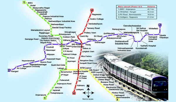
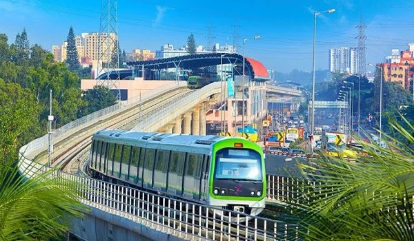
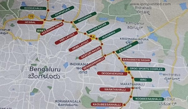
The Bangalore Metro map provides a detailed layout of the Namma Metro system, which serves as the city's rapid transit network. It has an operational length of 73.75 km and has 66 stations. It highlights the 2 main operational lines, the Purple Line, the Red Line, and the Green Line. These lines cover key areas and connect important hubs such as Majestic, Yeshwanthpur, and MG Road. The Pink, Yellow, and Blue metro lines have developed in some parts and are also under construction. The map includes metro stations, interchange points, and upcoming extensions, etc. This makes it easy for commuters to navigate across the busy urban areas of the city. With ongoing expansions, the Bangalore Metro map is constantly evolving to cover more regions. It focuses to help ease traffic congestion and improve connectivity.
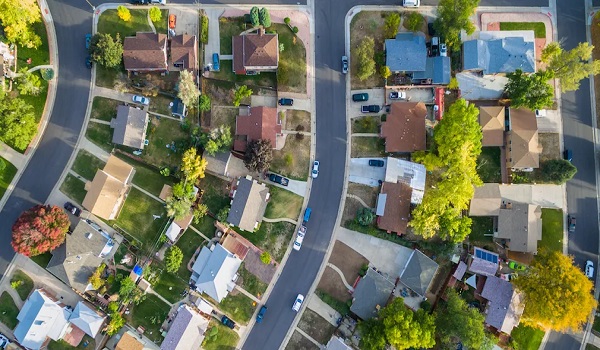
Bangalore has housed over 198 wards that are divided into different localities. These areas have housed premium residential options like flats, plots and villas. The residential area maps feature posh road connectivity like ORR and national and State Highways. These also show the nearest metro station, bus stop, and cab services. The map helps residents and buyers to locate the proximate schools, hospitals, colleges, and malls. Some of the top areas are Whitefield, Varthur, etc., which have housed grand housing ventures. One of the upcoming projects in the area is Prestige Raintree Park, a prestige Group project. Its location map features coordinates that help in tracing the venture easily. There are many more areas like E-City and Srajpur that are posh tech and residential areas.
Bnagalore's map helps in tracing all the features from the metro to tourist
places. The vastly populated city offers all the best road and metro
commuting facilities with a well-structured map.
The East Part of Bangalore is the best to live as it has housed the top IT
and residential areas like Whitefield, Varthur, etc.
Whitefield, in East Bangalore, is the best area for a job and to live. It is
home to more than 400 tech firms and has housed the largest tech park,
ITPB.
FAQS
| Call | Enquiry |


